Week 4 - Land
| Site: | Unitec Moodle |
| Course: | ENGGMG7109 - Resource and Environmental Management 2022 |
| Book: | Week 4 - Land |
| Printed by: | Guest user |
| Date: | Monday, 29 June 2026, 4:36 PM |
1. Land
- Step 1: Identify the activities for which a resource consent is sought
- Step 2: Conduct a Site Inspection
- Step 3: Talk to staff at the Council
- Step 4: Identify the environmental effects
- Step 5: How do I rank the effects?
- Step 6: Pre- application meeting (Complex)
- Step 7: Re-evaluate your proposal
- Step 8: Finalise the AEE
1.1. Subdivision Consent
Subdivision consent
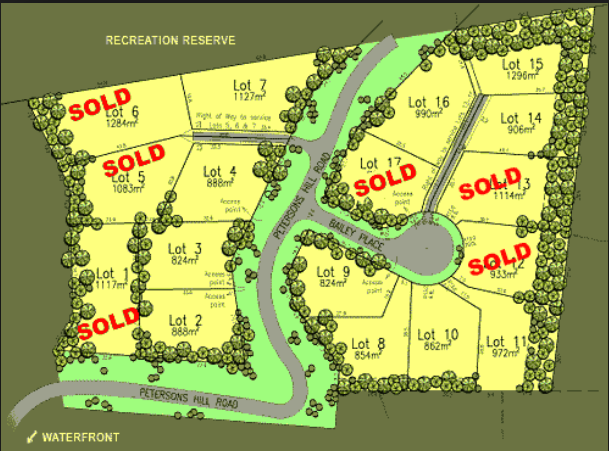 You need to obtain resource consent under the relevant district plan or Proposed Auckland Unitary Plan for subdivision activities, including:
- Creation of a new freehold title
- Creation of a cross-lease
- Creation of a unit title development, for example a block of flats
- adjustment to a boundary.
A subdivision consent will normally have a number of conditions which may require building consent and engineering approvals.
As well as fulfilling these other requirements, you will need to engage a licensed cadastral surveyor to prepare the necessary scheme/survey plan.
1.2. Activities affecting land
 Activities affecting land may include:
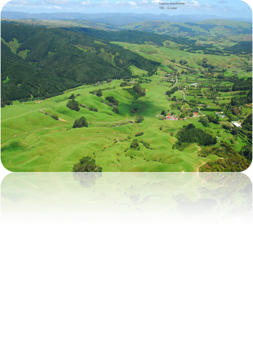
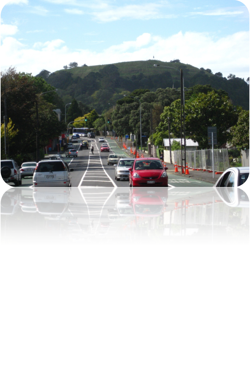
- Roads / Transport (e.g changes to the Pokeno road - how does it affect landform and how does this affect people living either side or the road. One mitigation for this work is the vegetative bund at the roadside which adds both an aesthetic quality and a noise barrier)
- Developments (Buildings)
- Coastal infrastructure
- Water infrastructure (large changes to subterranean structures, such as new wastewater mains, can affect land especially during building and maintenance.
- Agriculture / Farming (use and management of farms can affect the land environment)
- Power infrastructure (e.g windfarms can have a negative or positive effect on the visual quality of the land but this view is subjective).
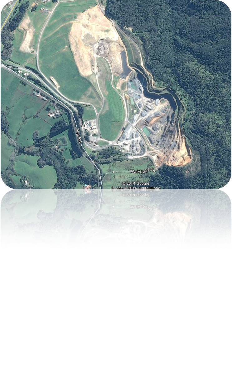
- Mining (often the effects are hidden but aerial photos demonstrate how the land is affected).
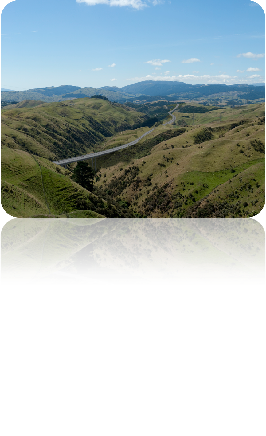
Case Study - Transmission Gully, Wellington
The new motorway at Transmission Gully will have a major affect on many local and visiting people to the Wellington area. Wellington has a single road access via a coastal road which is vulnerable to flooding and events such as earthquakes may also isolate the city. The proposed motorway over Transmission Gully (see photos) required significant landscape assessments.
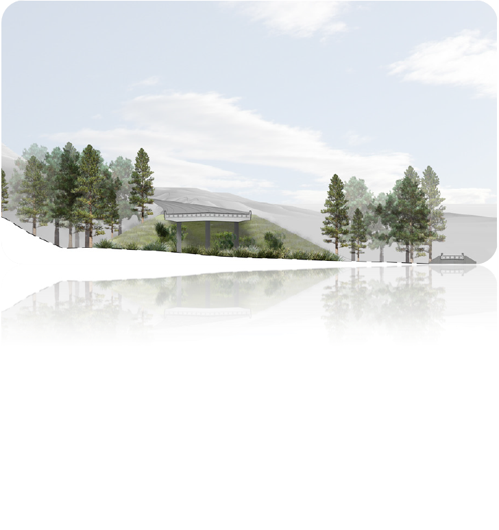 Landscape architects control landscape assessments. These are a very recent type of assessment which are very specialized and require a need to engage and understand the architects as this can be greatly influential in obtaining a consent.
1.3. AEE and contaminated sites
 RMA purpose (Section 5 ) is to promote “sustainable management of resources” For activities on contaminated land this includes:
- Safeguarding the life-supporting capacity of air, water, soil, and ecosystems.
- Avoiding, remedying, or mitigating any adverse effects of activities on the environment.
Thus for contaminated land an AEE must assess the nature of the discharge and sensitivity of the receiving environment to adverse effects. The National Environmental Standards (NES) for contaminated land can be accessed using this link - here
The National Environmental Standards (NES) include "Assessing and managing contamiinants in soil to protect human health". As part of this standard, you may need to provide a preliminary site investigation to prove that the land is not contaminated (if removing >25m3 soil). There may be a number of OSH issues with both handling and disposal of contaminated land. Often you can move contaminated land within the site boundaries as long as this activity is carefully controlled.
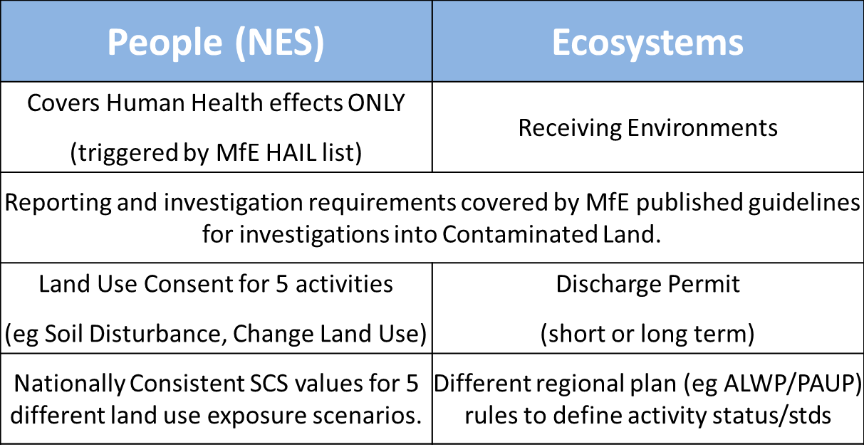
The RMA definition of environment includes: Ecosystems and their constituent parts, including people and communities (see table)
For this process, activities may be deemed permitted, controlled, restricted or discretionary where permitted activities represent the baseline. In this case no Consent may be r required usually due to small scale, short duration or low health risk activities on contaminated land. Defined by NES Regulations and relevant Regional Plans
For activities that are Controlled, Restricted, or Discretionary
- If permitted activity criteria not met consent is required as defined by the NES regulations or Regional Plan Rules
- AEE will cover contaminant control and discharge etc
- PSI, DSI reports will also accompany consent.
For more info on contaminated land assessments - follow this link.
1.4. Types of consent
 Landuse Consent- The term 'landuse' covers:
- Any activity done on the land, e.g. retail, horticulture, vegetation removal building, additions and alterations to buildings, and controls on buildings and structures.
- Land modification such as earthworks.
- The use of land also includes development on, under or over the beds of streams, rivers and lakes. This includes, for instance: constructing, using, or demolishing any structure such as a bridge or jetty.
-
Depositing any material or disturbing the river, stream or lake bed introducing any plant into a body of water.
-
Normally a land use consent is granted for unlimited duration, as long as the development detailed in the consent has been implemented to a significant level within five years (or a different period as written in the consent). If not, your consent will lapse.
- Any land use consent that is granted is attached to the property (as opposed to a specific person).
Although land-use consent are often associated with district/city councils, consents for earthworks may also be required from regional councils
Please follow this link to find an AUC doc on residential standards which is useful for planning houses in the Auckland region.
You may also need to consider whether or not you may need a tree consent. If a tree on your property is protected, you will need a resource consent to remove it, prune it, or carry out construction work near it (Auckland Council, n.d)
You may need to check any rules around trees on a property before you start work for which you can follow this link for more information, see trees - check before you chop.
1.5. Landscape Assessment
 Matters to be considered in the RMA:
As a general guide, matters to be considered when deciding an application for resource consent or a NoR are set out in RMA s104 and s171 respectively, and those relevant to an LSA include:
- Landscape and Visual Effects of the proposal;
- Policy statement and plan provisions relating to landscape and visual issues;
- Alternative locations or methods ; and
- Other relevant matters (e.g. non-statutory documents such as existing district-wide landscape assessment reports)
The matters listed above are subject to Part 2 of the RMA which has the over-riding purpose of promoting sustainable management.
- Section 5 Purpose and principles of the RMA
- Section 6 (a) Preservation of the natural character of the coastal environment … wetlands, lakes, rivers and their margins, and the protection of them from inappropriate subdivision, use and development
- Section 6(b) Protection of outstanding natural features and landscapes from inappropriate subdivision, use and development
- Section 7(c) Maintenance and enhancement of amenity values
- Section 7 (f) Maintenance and enhancement of the quality of the environment
Factors that can help in identifying valued landscapes include:
- Presence/absence of statutory landscape designations;
- Presence/absence of local landscape designations and associated controls;
- Landscape quality/condition;
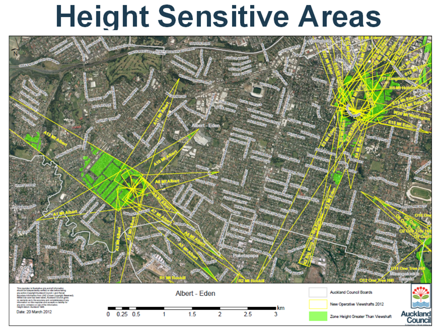
- Scenic quality (designated height sensitive areas help to prevent blocking of views such at the volcanic cones of Auckland)
- Rarity of particular elements/features;
- Representiveness;
- Conservation interest;
- Recreation value;
- Perceptual aspects; and
- Cultural / iwi.
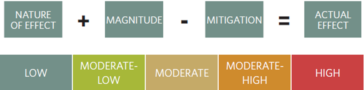
1.6. Magnitude of Effects
The nature of the effect that is likely to occur, i.e. its magnitude is determined by considering four separate factors, namely:
- Size/scale;
- Geographical extent;
- Duration;
- Reversibility
The LSA format should take the following form:
- Executive Summary Description of Proposal
- Relevant Statutory and Non-Statutory Provisions
- Existing Landscape
- Alternatives
- Landscape and Visual Effects
- Design and Mitigation Measures
Such a structure addresses the matters that need to be included in an AEE as listed in RMA Schedule 4(1).
References:
- http://www.aucklandcouncil.govt.nz/SiteCollectionDocuments/aboutcouncil/committees/planningurbandesignforum/meetings/planningandurbandesignforumminitem1320120529.pdf
- http://www.rmaguide.org.nz/rma/introduction/historical.cfm (Accessed 10:45am 2014/07/28)
- http://www.rmaguide.org.nz/rma/introduction/approach.cfm (Accessed 2014/07/29 11:59am)
- http://www.mfe.govt.nz/publications/rma/aee-guide-aug06/
- http://www.peel.co.uk/media/Peel%20Environmental/Bilsthorpe/Planning%20Application%20Nov%202013/ES/Volume%202/Appendix_7-1_Landscape_and_Visual_Impact_Assessment_Methodology.pdf (page 26)